Integration of Drone Technology in Yaeger Projects
Our most recent blog post highlighted several ways drones, or Unmanned Aircraft Systems (UAS), are being used in the AEC industry: orthophotography, mapping, and marketing. This week, we are sharing specific examples in which UAS devices are enhancing our deliverables. Under Yaeger Architecture’s recently awarded contract with the USACE Kansas City District, the Yaeger team is utilizing UAS to support the planning and design for the Combined Arms Center (CAC) campus renovation. This effort includes multiple historic structures located in the Fort Leavenworth, Kansas National Historic Landmark District.
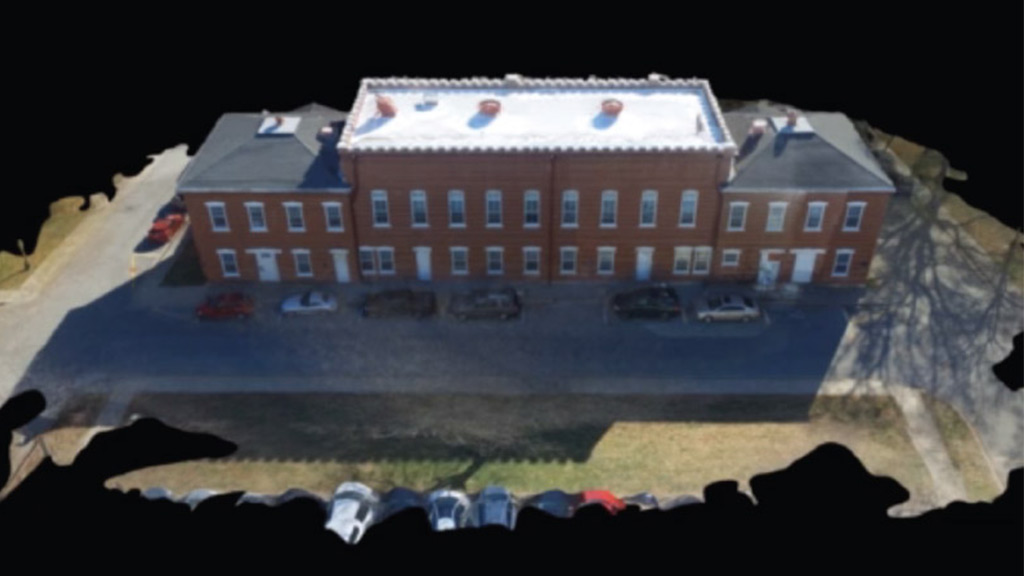
Working alongside Tukuh, an accomplished group of GIS professionals that specializes in a full range of spatial deliverables including mapping, visualization, modeling and real-time data processing, the Yaeger team is integrating state-of-the-art technology to protect and revitalize buildings that are more than a century old. The following images and this link show the orthophotography data which is being used to create a 3D model of the existing building.


Part of the Yaeger team’s scope of work includes a master planning study of the Fort Leavenworth, Kansas National Historic Landmark District. Since UAS can quickly cover large areas, are more versatile, and can be more accurate in capturing data using terrestrial surveying equipment, the UAS was utilized to map the district in its entirety. This information will be used by both the Yaeger team for the current task at hand and the Department of Public Works for future projects.
Finally, the Adams Toyota of Lee’s Summit, Missouri renovation is a great example of how UAS can help to collect great existing condition and marketing information. Crossland Construction’s drone pilot flew their UAS devise around and through the facility, collecting video of the final project. This information can be used by the project team to showcase their work to people around the world without having to visit the actual site.

Yaeger is excited to use drones in our practice to enhance our work. As the popularity of UAS devises increases, their use in the AEC industry will increase as well and we are ready to embrace the new technology.